
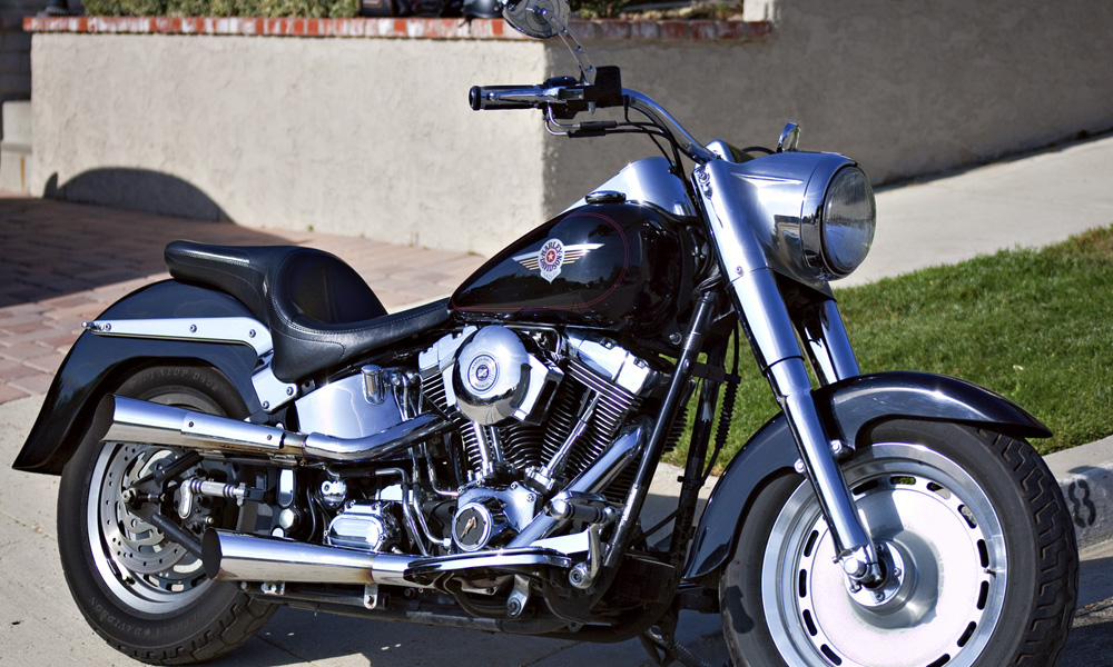
A couple weeks ago I hauled out my 2000 Fat Boy and got her all cleaned up for a trip down to Manhattan Beach to meet some of my fellow LAX retirees for lunch. We met at the North End Caffe which just happens to have been featured Diners, Drive-Ins & Dives. If you’re ever in the area, there are a couple things on the menu that I highly recommend. The Kahlua Pig Monte Cristo Egg Rolls are as tasty as they are unique and more of a meal than an appetizer. The Fettuccine Carbonara (one of their signature dishes) is fantastic. Great food and awesome friends – I always look forward to our ExLAX get togethers.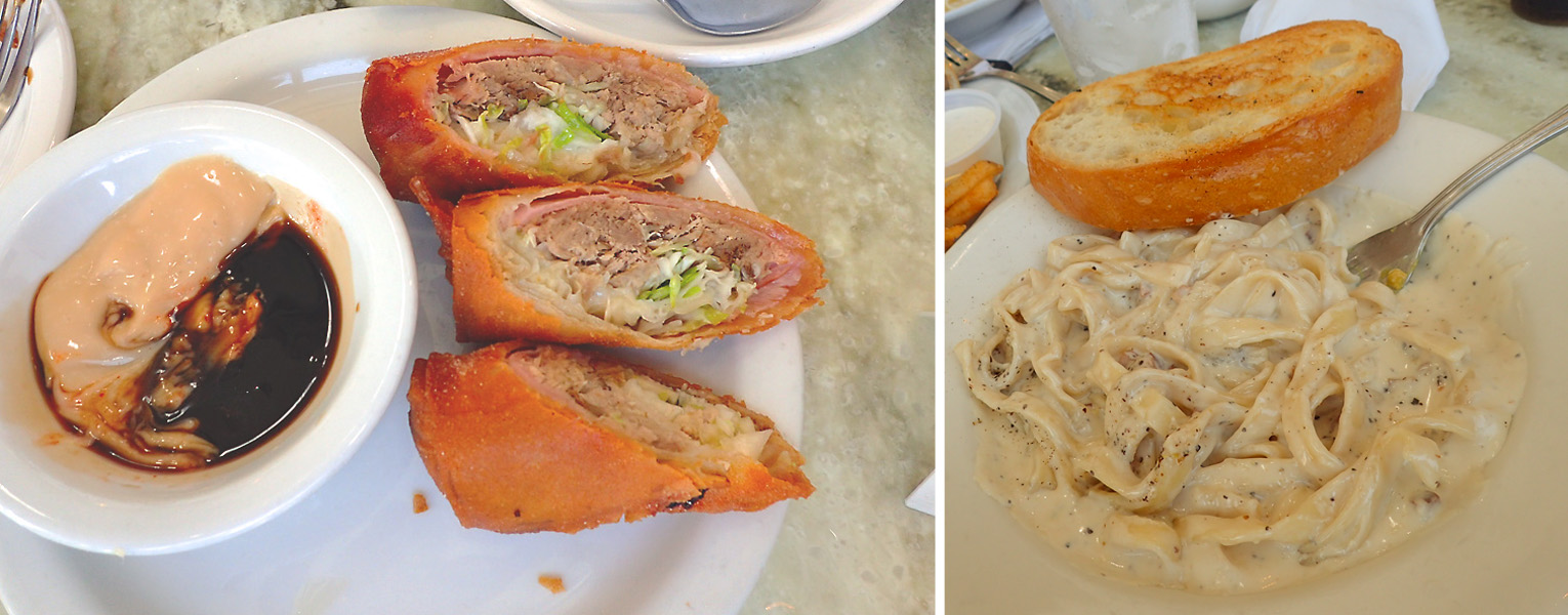 The ride back and forth to lunch reminded me of just how much fun I have on this bike. Right away, I started thinking about where and when I could go for a blog post ride.
 Along the ridge line of the Santa Ynez Mountains, just above the town of Santa Barbara, California you’ll find a seldom traveled stretch of asphalt aptly named Camino Cielo or “Sky Road”. Hwy 154 separates East Camino Cielo from West Camino Cielo. From hwy 154, “West” is 4 miles of paved road that turns to dirt at the Winchester Canyon Gun Club. If you have a dirt bike and some skills, I’m pretty sure you can take the dirt road down into the town of Santa Ynez; someday I’ll do that… “East” takes you along the mountain ridge and if you’re here during the week, you’re likely to be the only one on the road.
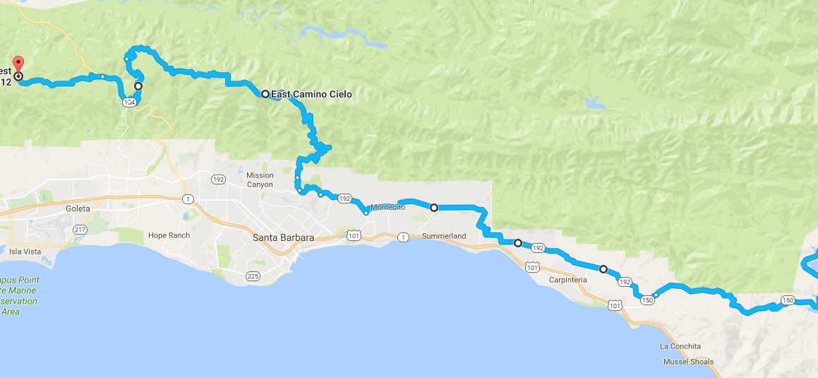 This whole area is a great place to ride, tree lined roads, beautiful mansions, polo grounds, flower farms, and perfectly manicured golf courses are just some of the things you can expect to see. In addition, if you take the back roads (the only way to go) you can have lots of fun going through the turns along the way.
It’s been plenty warm here over the past couple weeks, so although it was cool just after dawn this morning, I was enjoying the chill knowing it would be a fond memory by the time the afternoon rolled around. The back road into Ojai goes through the town of Santa Paula, and right past their vintage train station. Southern Pacific put the railroad through in 1887 but in 1904 a shorter route through the Santa Susana Pass relegated this stretch of track (between Saugus and Ventura) to local use. Up until 1950 it was used to haul citrus back and forth to packing houses and communities along the Santa Clara River. These days, the track is owned by the Fillmore & Western and the only trains that run are involved in filming (over 400 movies and commercials) or for entertainment and tourism.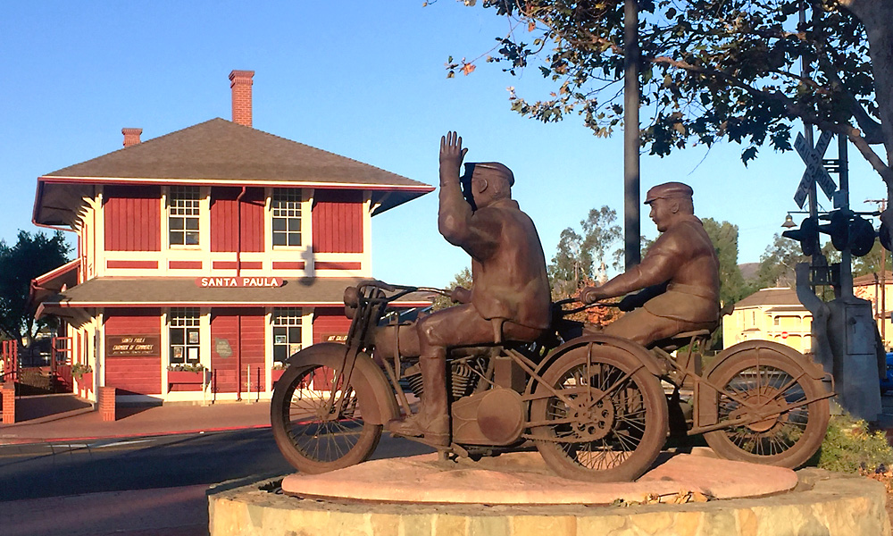 Forged in steel by Santa Paula artist Eric Richards, The Warning commemorates the heroism of the Santa Paulans who worked to save lives during the St. Francis Dam Disaster. The newly completed 200-foot tall St. Francis Dam, was located five miles northeast of Newhall and collapsed just before midnight on March 12, 1928. As the deluge approached, two Santa Paula police officers rode their motorcycles through the low lying areas of town, warning residents to evacuate. The floodwaters swept down the Santa Clara River valley to the ocean, claiming 425 lives. It remains the second-greatest loss of life in California’s history, after the 1906 San Francisco earthquake and fire.
 After a stop at Don Lalo’s for breakfast I was back on hwy 150 out of Ojai and was quite surprised when I saw just how low Lake Casitas is. Look at the boat launch ramp (white paint on asphalt for comparison). Sure will be nice when we start getting some rain again.
Gibraltar Road leads you up from Montecito to East Camino Cielo. Imagine my surprise when I came up on these two near the top, getting ready to launch a hang glider off the side of the mountain. They were very kind and allowed me stand around while they prepared and then document their departure – looked like fun, a little scary but fun.
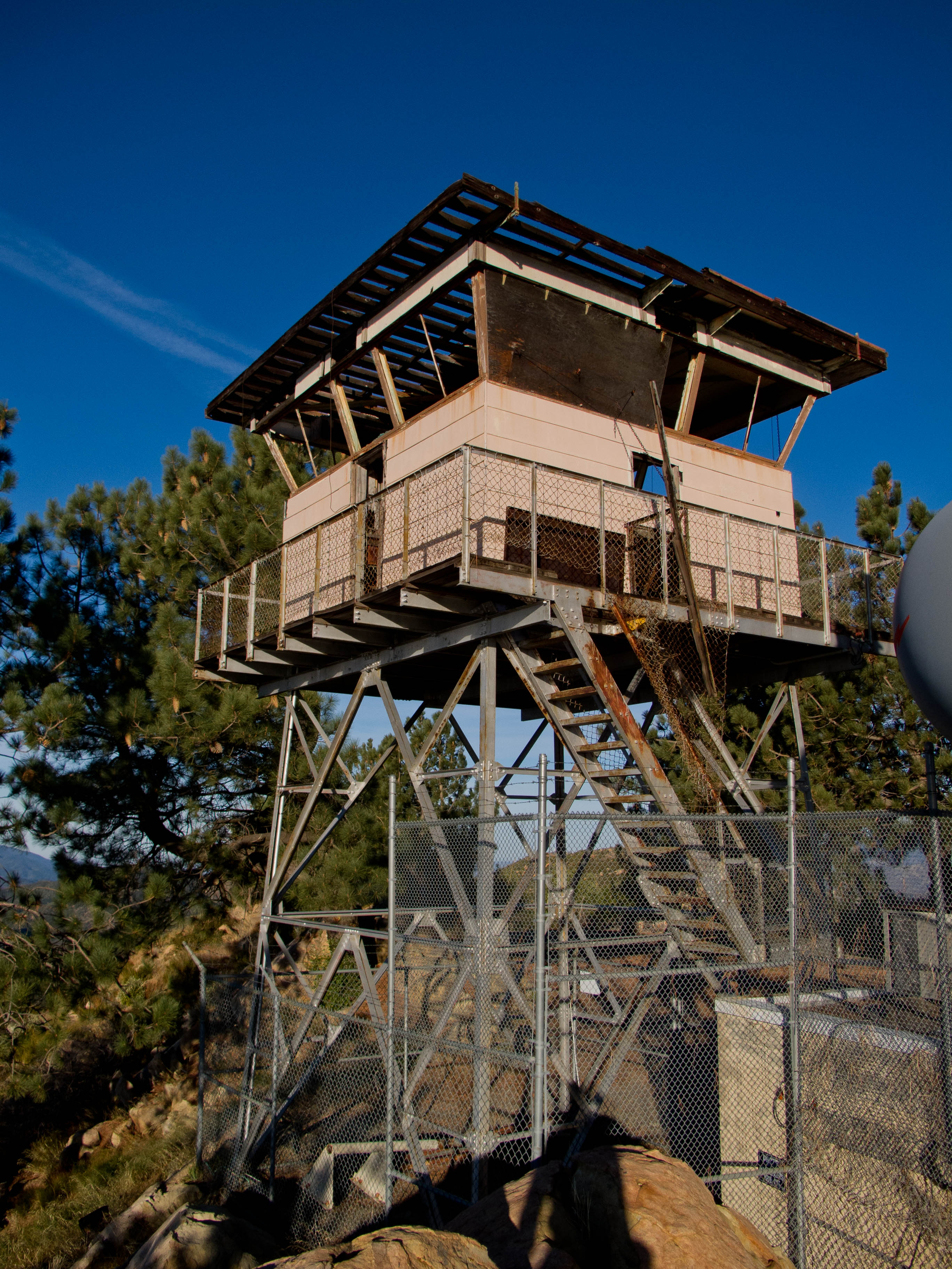
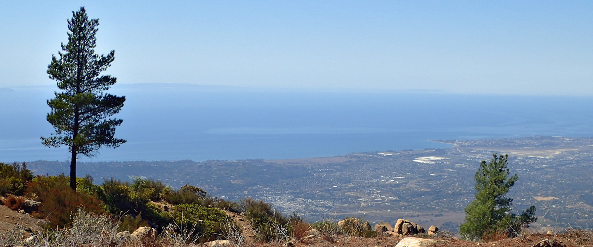
I love coming up here to ride this ridge line road – mountain on your right and the ocean and Santa Barbara on your left. “Top of the World”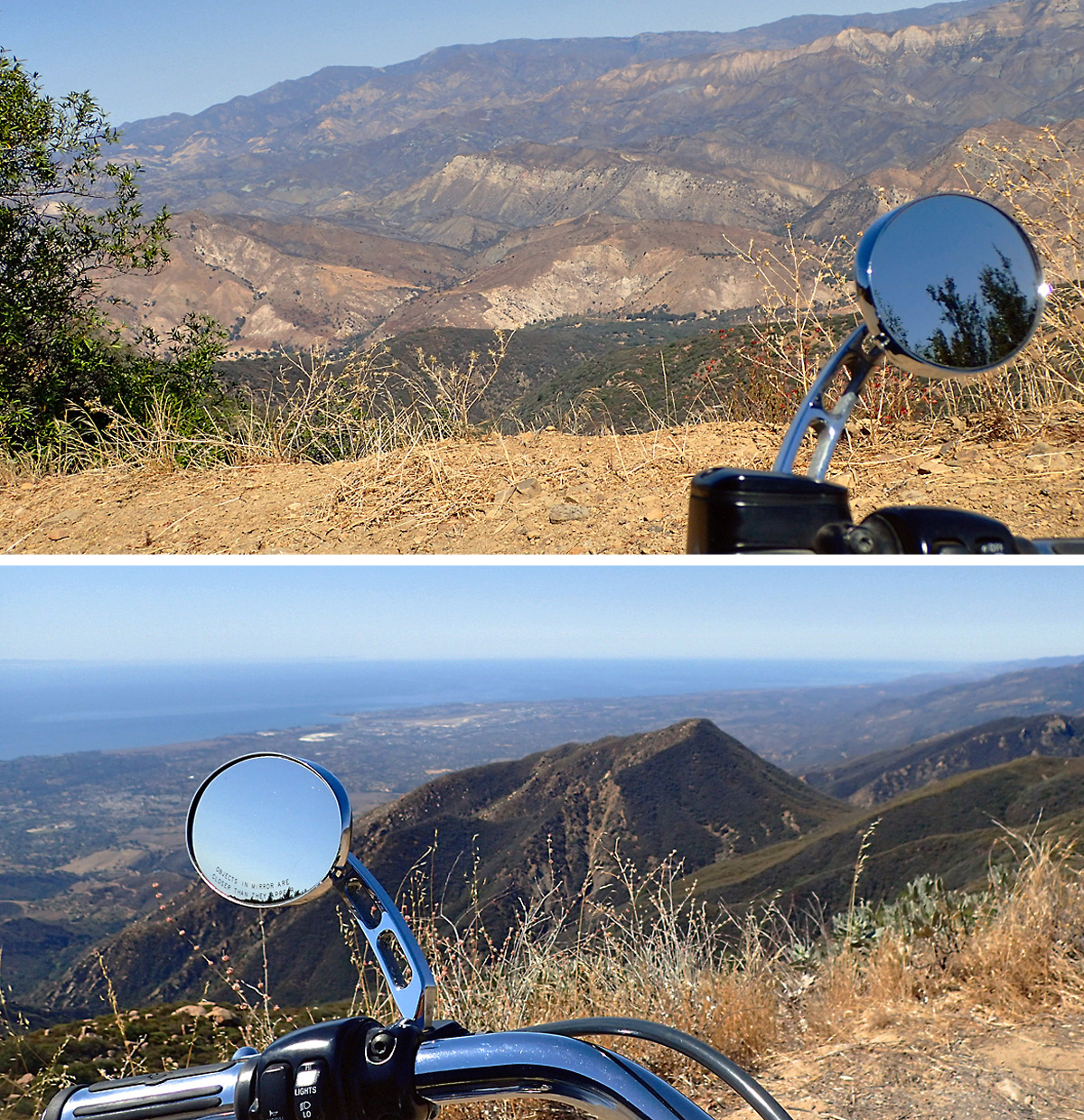 My next stop, just a couple miles up the road, was the La Cumbre Peak lookout station. At nearly 4,000 feet, this is the highest peak around. I’ve gone past several times, but this is the first time I’ve made the hike from the road up to the lookout. The fire lookout has obviously been abandoned for some time, but what a spectacular view from up here. There are actually a couple picnic tables, bring your camera .
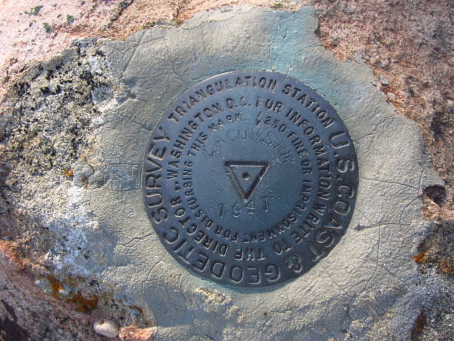
This is a picture of the La Cumbre Peak U.S. Coast Geodetic Survey Benchmark (click image to enlarge). I found the place where it’s supposed to be but it looks like someone stole it. They’re more common the closer you get to civilization but I’ve never seen one in the middle of nowhere. Still haven’t……
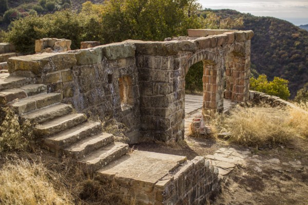
Ever hear of a place called Knapp’s Castle. George Owen Knapp, founder of Union Carbide, built Knapp’s Castle shortly after purchasing the 160-acre parcel back in 1916. In 1940, Dr. Frances Holden bought the property for $10,000 and invited her friend, world-famous opera singer Lotte Lehmann, to move in. The mansion was destroyed by a forest fire only five weeks later, and now only the massive sandstone foundations, fireplace pillars and walls of the original seven structures remain intact. The property is still privately owned but is open to the public. Here’s a picture of the some of the ruins and the view of Santa Ynez Peak out the window opening. The other “windows” look down the Santa Ynez River Valley toward Cachuma Lake – that thing is barely a mud bog these days.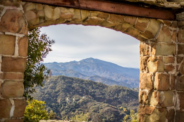
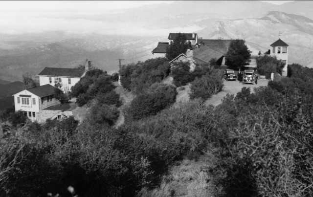 Twenty-four years was probably a pretty good run. You gotta know that there was no fire support way up here back then and where would you get enough water to fight a fire? Too bad really, I think this is a far better location than Hurst Castle.
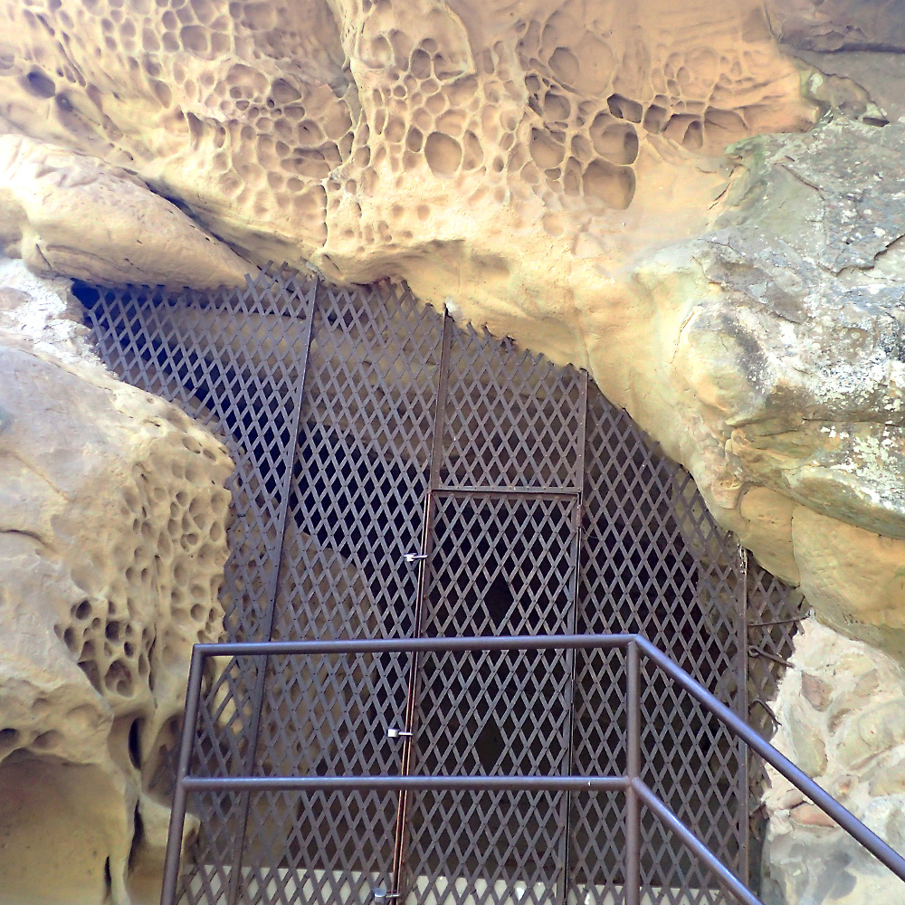
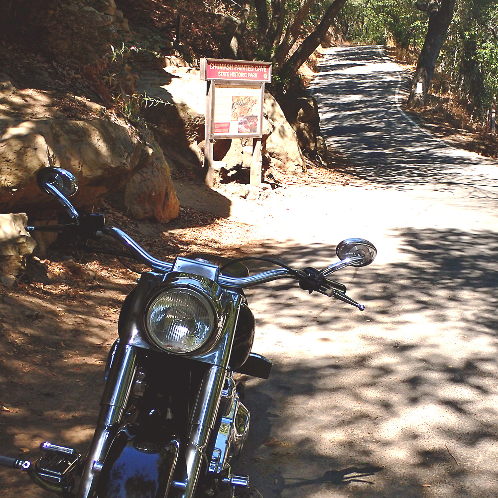 A mile down the road, a left turn on Painted Cave Road takes you through the small community of Painted Cave, to Chumash Painted Cave State Historic Park. The “parking lot” is a tiny shoulder on a road that’s so narrow it has no center line. The cave is only 12 steps from the street. There is some graffiti but they know that was done by early settlers due to the correct grammar. A protective barrier was installed and whomever is in charge of that deserves a medal, as it is still well preserved.
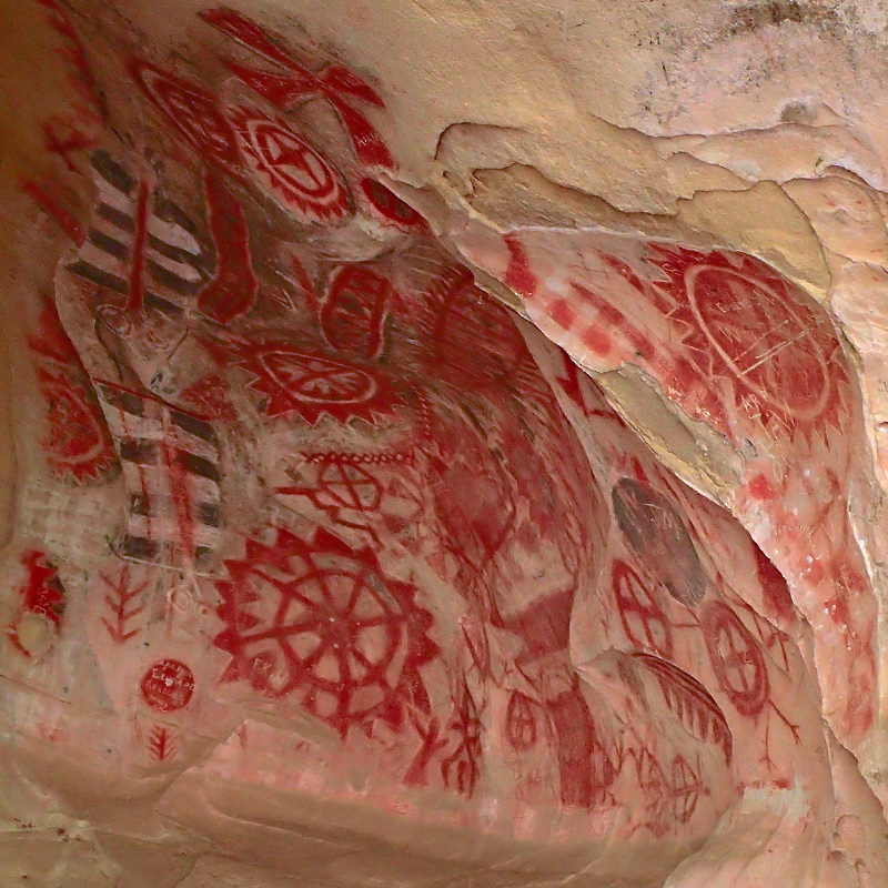
 They know that the Chumash are the people that made these drawings using charcoal, red ochre, and powdered shells. The individual tribesmen were probably shaman or priests who came to the cave seeking power or spiritual strength as they tried to influence supernatural beings and forces to intervene in human affairs – probably more than a little peyote involved…. And what’s up with all those pockmarks in the sandstone around the cave?? Maybe that’s where they kept their crayons.
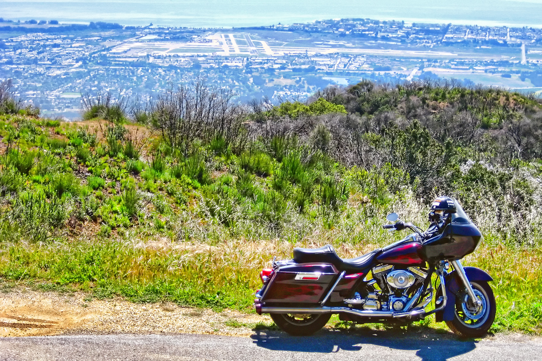
 Painted Cave Road is about the end of East Camino Cielo. As I told you, the west road is fairly short but it has it’s attractions. It is also very solitary (after you get past the houses) and you’re right above Santa Barbara Airport. I have been here with both bikes and have several pictures but this one is my favorite – that’s my old Road Glide with the old paint.
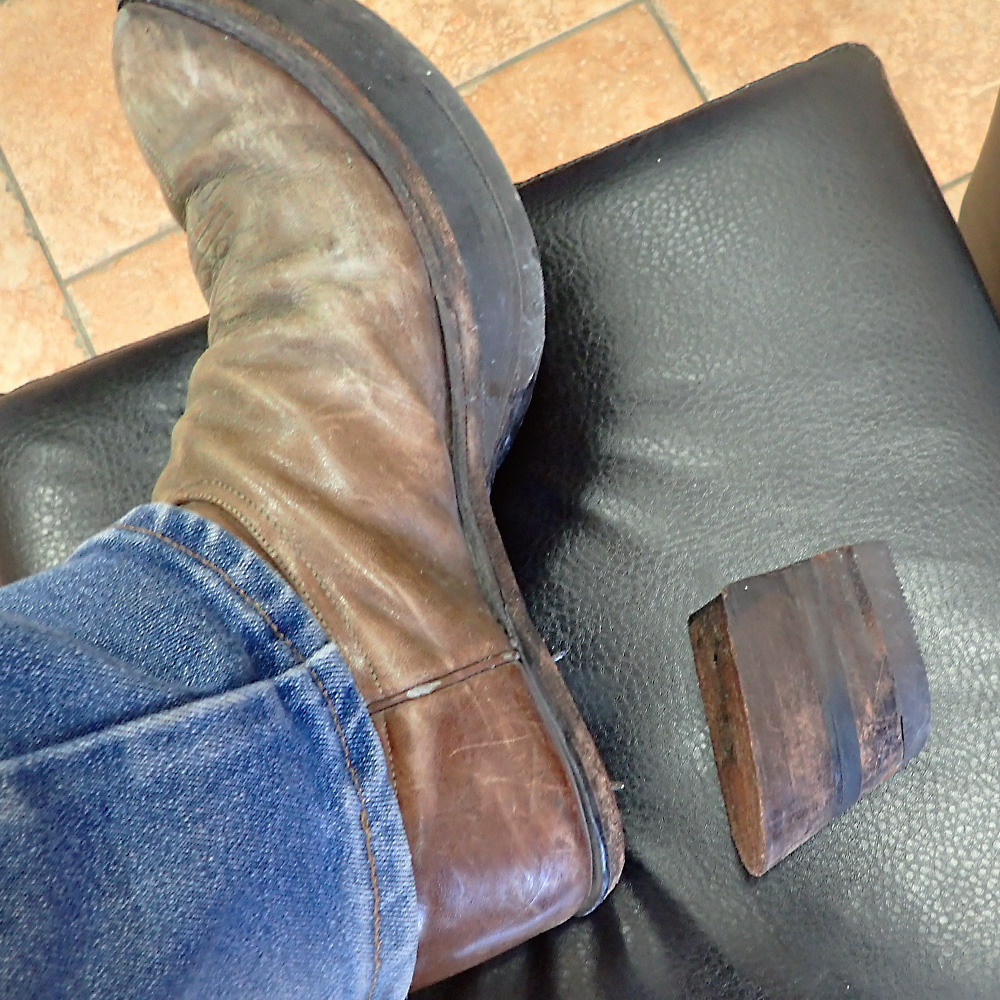 I didn’t go over to West Camino Cielo, and I didn’t go to Knapp’s Castle either. I intended to, but way back at the hang glider flight – the heel came off my left boot. After hiking up and down La Cumbre Peak with no heel on my corrected boot, I was pretty much done walking. I did go down into Santa Barbara and tried a couple of shoe repair shops with the intention of going back up and finishing my ride if I could get my boot fixed – but they were no help. So, the ride got cut a little short.
All in all, it was a great day for me; I hope you enjoyed it as well.
Amazing write up! They never cease to amaze me! After so many times you and I rode in the area, I had no idea the history of the area! Maybe another ride through the area is due.