
I planned this ride back in December but I got the flu for a New Year’s present and after I got that kicked enough to go on a motorcycle ride, there was rain and other commitments that just kept me off the bike. SO – this is a little late but it was worth the wait.
You know by now that I prefer the road less traveled to the interstates but there are times that it can’t be avoided. Mostly due to the short winter days, portions of today’s ride required some mile eating time up on the slab. However – the great back roads experience more than made up for the few miles spent on the concrete superhighway where you spend most of your time protecting yourself from the texting, shaving, make-up applying, or otherwise brain dead drivers mindlessly pointing their death dealing machines. (apologies to all of my readers; I know you are paying attention while driving).
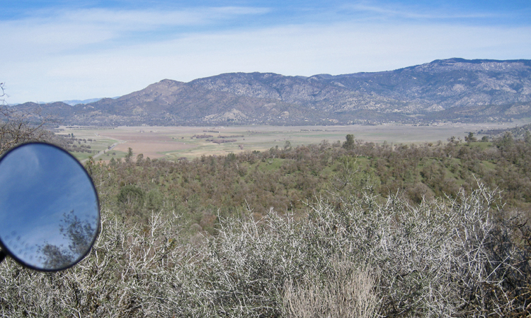
Usually when I go up towards Palmdale I use Sierra Highway to avoid the 14 freeway. However, Soledad Canyon Road is actually better if you’re not in a big hurry. I’ve taken this route before but today was a great reminder that I need to take it more often.
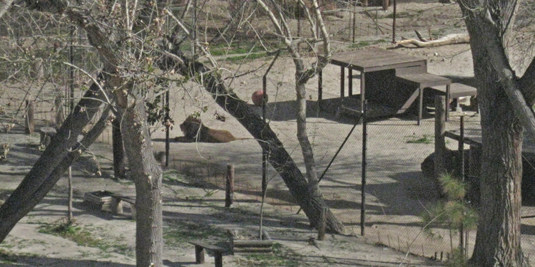 Just south of Acton you’ll notice the fence on the side of the road goes from four feet and barbed wire to fourteen feet and extra heavy chain link topped with barbed wire. This is the location of the Shambala Preserve. Back in 1972 Tippy Hedren established this animal sanctuary that cares for endangered exotic big cats such as African lions, Siberian tigers and Bengal tigers, leopards, and even a liger (lion/tiger mix). Most of the animals at Shambala were born in captivity, orphans, are no longer wanted at circuses or zoos, or are given up by private owners who could no longer care for them. I stopped to look through the fence but couldn’t see any animals so I started walking back to my bike – then I heard a loud roar followed by another answering roar; this happened two or three times. I’ve never heard a lion roar in real life, it is IMPRESSIVE (you can actually feel it). I headed in that direction and got to see the King of Beasts himself make his last roar then he laid down in the sun. You can get a tour of Shambala but reservations are required.
From Acton I headed for Tehachapi Mountain Park, just because I’ve never been there. A few miles on the slab then a left turn at Roseamond and a right turn on Tehachapi Willow Springs Road. This back road into Tehachapi is new to me but will be the preferred route from now on; a nice smooth road with long sweeping turns and almost nobody on it.
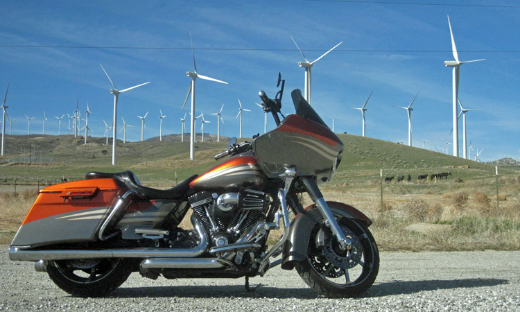
Ever wonder what one of these babies cost? The big ones are 3-4 MILLION installed. These are located in the hills west of Mojave. The little black things are horses.
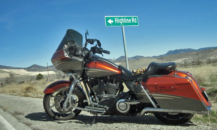 This is horse country and I’m sure that’s where this road got it’s name. A Highline (picture) is a line put up between two trees to tie horses, mules, etc. I made one for Robin to use when she goes horse camping and she loves it.
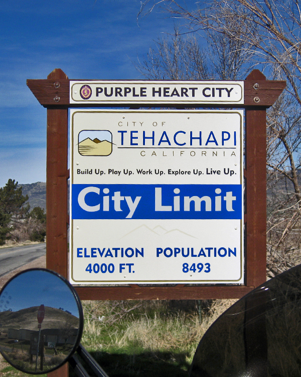 I didn’t take any pictures from Tehachapi Mountain Park but I can tell you that it’s all pine trees up there and at 5,600 ft and it’s cold this time of year. Tehachapi is a nice place, small enough to be mostly rural but with just enough of the modern conveniences.
In case you were wondering, the Purple Heart City proclamation is a way of honoring the sacrifices of those that were either wounded or killed by the action of enemies of the United States during war time and has nothing to do with the number of Purple Heart recipients living in or from the City.
From Tehachapi I headed for Lake Isabella. I was on 58 for about 10 miles then turned right to Caliente. Although almost a ghost town now, Caliente prospered during Southern Pacific Railroad’s construction of Tehachapi Pass line. For a time, the Telegraph Stage Line and the Cerro Gordo Freighting Co. also ran through Caliente and its full-time population grew to 200. There were approximately 60 buildings, including 20 or more saloons. The buildings still standing are mostly dilapidated and uninhabited.
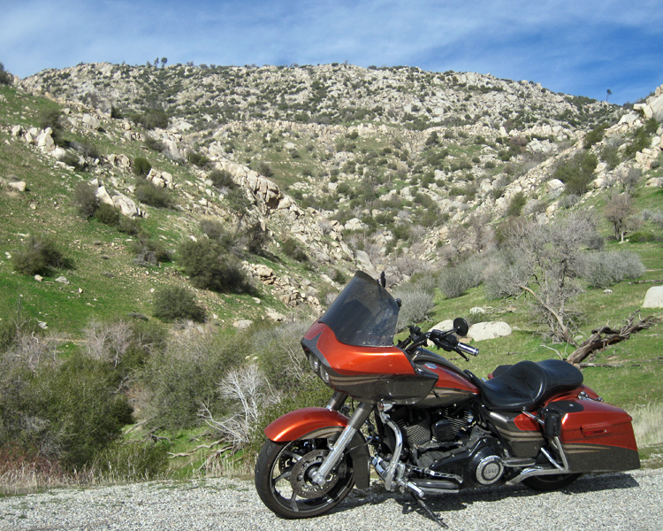
 The Caliente Bodfish Rd is not a road less traveled, it is a road NOT traveled. 95% of the road doesn’t even have a center stripe, which makes navigating the right hand turns a little interesting. It didn’t matter much though, speed in the turns was about 15 mph and there was nobody on the road. Great mountain road that really allows you to enjoy the view.
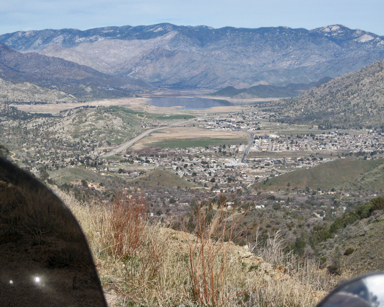
Looking down on Bodfish and Lake Isabella. Only other way to get this view is from an airplane.
Highway 178 southwest of Lake Isabella.
Highway 178 goes down the Kern River Valley and follows the Kern River from Lake Isabella. I would have taken a picture of the river had it been impressive but it was barely a trickle in most places. Still, 178 is a GREAT road especially after it goes down to one lane each direction. The speed limit is 55 and you can go that fast in just about every turn – if you’ve got the stones to do it, and are unencumbered by slower vehicles. If my dad ever gets out to CA with his SlingShot – this will be THE road when we go for a ride.
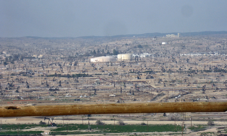
The view from Panorama Park in Bakersfield – nothing but oil wells in the Kern River Oilfield.
This is where we get to the Dead Dinosaurs. We take a lot of things in life for granted; what do you think this world would be like without oil? I hope they can find an alternative fuel or a way to affordably and renewably manufacture petroleum products because eventually the oil will dry up. I am absolutely thrilled however, to be living in the time of gasoline, diesel, and jet fuel, and to know that it won’t run out in my lifetime.
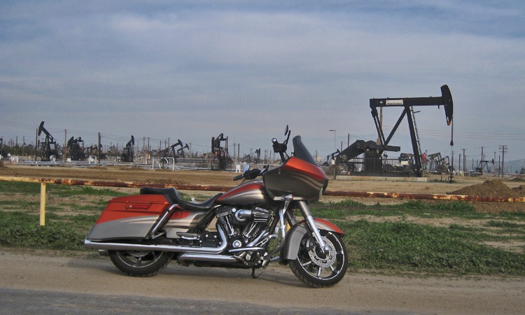
Paying homage to the Nodding Donkey that pulls its life blood from the ground.
My carbon footprint might be slightly bigger than it should be, but I assure you, nobody is having more fun spending their carbon credits. See you on the road…..
Great pics and story . Ride well my friend .